
Spring 2026 / flight presentation
Follow the flight.
Read the evidence.
The team’s authored map and altitude profile show the published flight story. They are presentation figures, not a live tracker. Raw telemetry, coordinates and analysis files stay private.
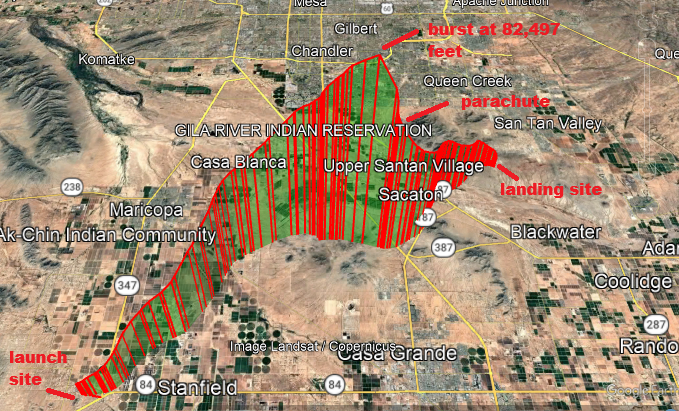
The team’s published trajectory
Original map from Spring 2026 launch acquired data. The graphic is preserved without distributing a coordinate dataset.
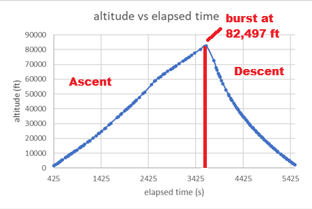
Altitude and burst
The authored figure annotates 82,497 ft after about 61 minutes. This is the report’s flight channel, not an independent synchronized APRS measurement.
Source: team-supplied Spring 2026 acquired-data report. Original documents and numerical records are retained privately. Browser images remain viewable as part of the public presentation.